.png)

.png)
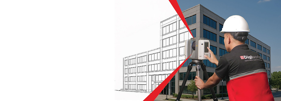
Digital Site Capture.
Done Right.
With two decades of industry experience,
we capture and deliver accurate spatial data of your site so you can plan, manage,
and build with confidence.

When you see the full picture,
you can build something great
Accurate and comprehensive data is the cornerstone of any project’s success.
Our Reality Capture Solutions transform physical spaces into accurate Digital Twins – helping our clients plan, manage and build safely and more effectively.
OUR SOLUTIONS

3D LASER SCANNING
3D Laser Scanning uses LiDar technology to create a detailed Digital Twin of the physical environment.
It provides teams with the spatial data they need to analyze, plan and design more efficiently.
It is used to produce accurate and comprehensive
2D As-built Plans, 3D Models, and BIM.
The gold standard in as-built documentation
Get Accurate and Comprehensive
2D As-built Plans and 3D Models


Openspace is a powerful construction management tool that helps teams finish projects on time and on budget.
It uses 360° cameras and AI computer-vision to help you effortlessly document and track site progress.
Get complete documentation of your construction site from start to finish
Perform Remote Site Inspections,
Organize Tasks, and Monitor Progress
from one user-friendly platform.


GPR
Ground Penetrating Radar (GPR) uses
high-frequency waves to detect structures beneath the surface.
It allows teams to safely dig or locate buried infrastructure. Making it an essential solution for utility mapping, construction, and and archaeology.
Safer sites start below ground
A non-invasive solution to detect and map utilities or structures beneath the surface
GROUND PENETRATING RADAR


An immersive marketing tool
to showcase your property
Turn real spaces into stunning interactive 360° walkthroughs
A powerful marketing tool that enables viewers to digitally explore a property on desktop, mobile, or VR headsets.
It gives clients access to high quality images, 360° photos and unique views – giving them a variety of visual materials they can use to better market their properties.


Using drones equipped with high resolution cameras and LiDar technology, we can map large areas quickly and accurately.
We generate 3D Models, Topographical Maps, Digital Elevation Models and Orthomosaics to help our clients view and assess their sites from above.
.png)